
Agricultural Drone Platforms
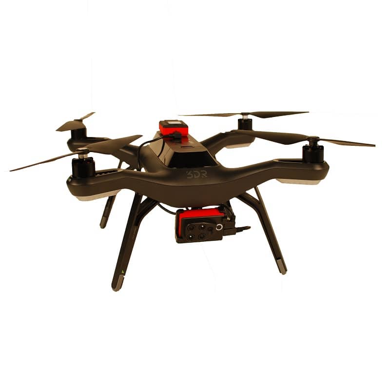
Multi-spectral UAV platforms for NDVI crop mapping, scouting and variable-rate precision application.
A single drone survey covers 100 km² per day, replacing weeks of manual scouting.
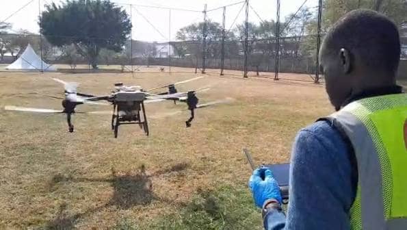
Agricultural drones equipped with multi-spectral and RGB cameras generate NDVI and NDRE vegetation index maps across entire farm blocks in a single flight, identifying crop stress zones, disease hotspots and irrigation failures 7-14 days before they are visible to ground-level scouts. Jos•Hansen supplies professional-grade UAV platforms from DJI Agras and Parrot for both mapping and precision spray application, with full commissioning, pilot training and seasonal flight programme support. Every drone deployment is integrated with the farm’s agronomic programme, translating map outputs into actionable intervention prescriptions rather than raw data files.
NDVI crop mapping
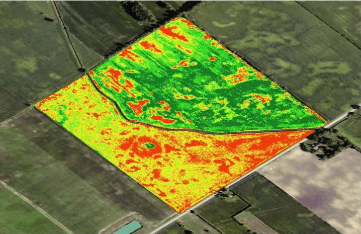
Multi-spectral flights generate NDVI and NDRE vegetation index maps across full farm blocks in a single mission. Stress zones, disease patches and irrigation failures are identified at 5-10 cm resolution before ground-level symptoms develop, giving the management team a 7-14 day early intervention advantage.
Precision spraying
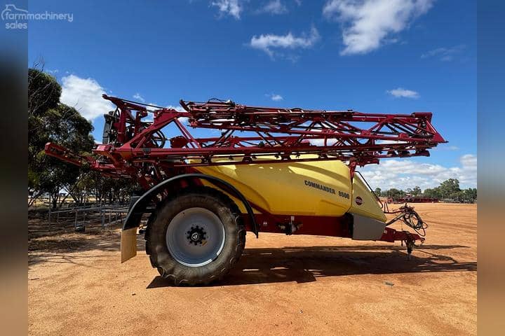
DJI Agras spray drones deliver crop protection chemistry at variable rates guided by NDVI prescription maps, applying product only to stress zones rather than broadcasting across the full block. Variable-rate aerial application reduces total product use by 20-40% versus blanket ground application while targeting the areas that actually need treatment.
Fleet management
Multi-drone fleet programmes cover commercial farm blocks of 500-5,000 hectares within operationally practical flight windows. Jos•Hansen fleet management support includes flight planning software, battery logistics, data processing pipelines and agronomist report generation for every survey mission.
Multi-spectral mapping identifies stress before symptoms are visible.
Plant cells under stress reflect near-infrared light differently before visible symptoms develop, allowing NDVI maps to detect drought stress, nutrient deficiency and early-stage disease 7-14 days ahead of ground scouting. Jos•Hansen mapping missions use Parrot Sequoia and MicaSense RedEdge multi-spectral sensors mounted on fixed-wing or multirotor platforms calibrated against ground reference panels for quantitatively accurate reflectance data. Flight outputs are processed into zone maps that classify the field into management zones by stress severity, with each zone carrying a specific recommended intervention from the Jos•Hansen agronomist team. Mapping at 10-14 day intervals across the season builds a temporal picture of crop development and stress evolution that guides the full input programme.
Variable-rate aerial spraying applies chemistry only where needed.
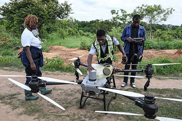
DJI Agras T-series spray drones carry 20-40 litre tank payloads with independently controllable nozzles that adjust application rate per metre of flight path based on prescription map inputs. Spot-spray missions targeting only the stress zones identified in the preceding NDVI survey reduce total fungicide and insecticide volume applied by 20-40% compared to blanket broadcast applications. Reduced application volume lowers input cost, reduces operator exposure, and cuts the total pesticide load on the crop, which is increasingly important for export-market residue programmes. Jos•Hansen spray drone programmes include pre-season calibration, real-time flight monitoring and post-application efficacy surveys to validate that treated zones responded to the intervention.
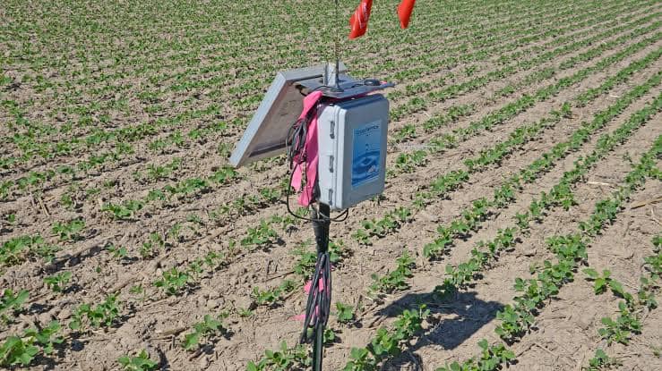
Connected ground sensor networks close the data loop.
Drone survey data combined with ground-based IoT soil moisture and weather sensors creates a complete picture of crop performance that neither source provides alone. Jos•Hansen integrates drone survey outputs with soil sensor networks to correlate surface stress signatures with subsurface soil moisture and temperature data, distinguishing drought stress from disease stress or nutrient deficiency before prescribing a response. This combined data feed is delivered to farm managers via a cloud dashboard updated after every flight and every sensor reading cycle, accessible from any device in the field. Integration with satellite imagery for background trend analysis and long-term seasonal comparison is included in the full precision agriculture programme.
Technical specifications.
Survey platforms
DJI Mavic 3 Multispectral, Parrot Sequoia, MicaSense RedEdge series
Spray platforms
DJI Agras T40, T20P for variable-rate precision application
Coverage rate
Up to 100 km² per day for survey; 10-15 ha/hr for precision spray application
Sensor bands
RGB, Red, Green, RedEdge, NIR (multi-spectral); thermal optional
Output maps
NDVI, NDRE, GNDVI, canopy height, thermal stress, chlorophyll index
Training support
Pilot certification training and flight programme support included
Early detection advantage of multi-spectral drone mapping over ground-level visual scouting for crop stress, disease hotspots and irrigation failures across large farm blocks
Daily survey coverage achievable with a professional agricultural drone platform, replacing manual scouting teams across commercial farm blocks in a single flight day
Reduction in total crop protection chemistry applied when variable-rate drone spraying targets only NDVI-identified stress zones versus blanket broadcast application
Why Agricultural.
7-14 day early warning
Multi-spectral stress detection precedes visible symptoms by 1-2 weeks, giving the management team an intervention window before damage becomes uneconomical to correct.
Zone-specific application
Variable-rate spraying targets only problem zones identified by NDVI mapping, reducing total chemistry use by 20-40% versus blanket programmes.
Full season data record
Sequential drone surveys across the season build a temporal stress map that informs the following season’s input programme and identifies persistent problem areas for targeted soil investigation.
Speed at scale
100 km² per day survey coverage replaces weeks of manual scouting on large commercial blocks, making real-time crop intelligence economically practical at commercial farm scale.
Partner with Jos Hansen
Talk to our procurement and operations teams about your next infrastructure, healthcare or scientific deployment.